Learning Objectives
- Identify best practices for using Sanborn Insurance Maps in the classroom.
- Create a lesson plan to integrate Sanborn Insurance Maps into instruction.
Sanborn Insurance Maps Lesson Plans
Use Sanborn Insurance Maps, Google Earth, and the Ohio History Connection: Remarkable Ohio website to develop a lesson plan using primary source documents. Keep in mind that historians use multiple primary source documents when forming their conclusions. It will be important to include more than one primary source document for your students.
Other primary source document databases include:
Digital Public Library of America
Docs Teach
Library of Congress
The National Archives
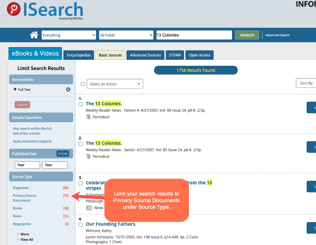
You can also find primary source documents by limiting your search results in INFOhio's ISearch to the source type: Primary Source Documents. For more information on how to use ISearch in your classroom, check out the ISearch for Inquiry class in the 6-12 Digital Content Learning Pathway.

Create a Lesson Plan
Download the Sanborn Insurance Maps Lesson Plan Template from the exercise files at the bottom of this page. Consider the discussion/reflection you have done and the materials you have learned about so far. Use the lesson plan template to create a standards-aligned lesson for your students using Sanborn Insurance Maps. Consider sharing the lesson you create in INFOhio's Open Space.
Another example of a lesson using maps is the Map It Out HyperDoc Lesson Plan which uses a blended learning and inquiry-based approach to engage learners. Multiple resources are used in this lesson including World Book Kids, World Book Student, World Book Timelines, and Google Maps. A teacher guide is also included.